High-quality and automated image processing
MAPEO is a drone based high-throughput phenotyping solution for research and breeding. MAPEO provides set of image processing tools to create a digital twin of your area of interest. This gives plant breeders, researchers and agricultural field managers a more complete and objective view on experimental field trials of any size. Discover more about MAPEO to get better and faster insights in your field trials.
Create high-quality information products
MAPEO is an end-to-end online platform. After creating a personal account you can easily use all available tools and services to create several trait measurements at critical times during the growing season.
- Orthomosaic, digital elevation model
- Height
- Lodging
- Leaf cover
- Vegetation indices
- Flowering intensity
- Growth curves Emergence
- Early vigo
- Stand count
- Leaf angle
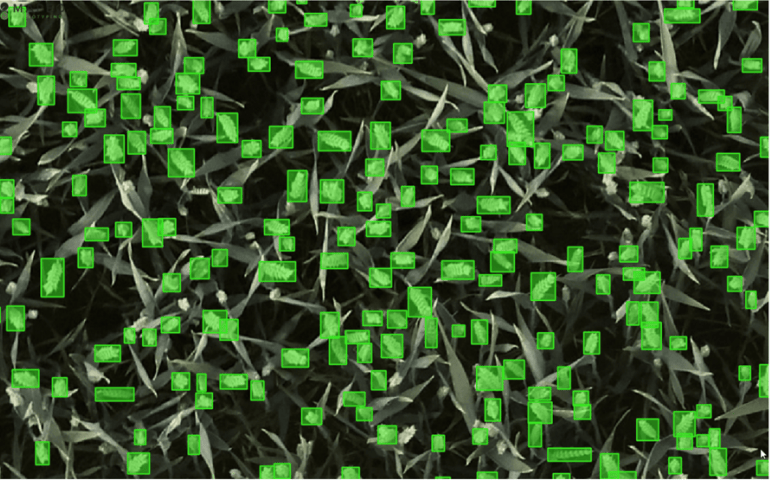
- Organ / fruit count
- Flower count
- Disease detection