Jeroen Degerickx
R&D Professional
Jeroen obtained a Master’s and PhD degree of Bioscience Engineering at KULeuven in 2012 and 2019 respectively, and is particularly skilled in using remote sensing, GIS and spatial modelling as tools to better understand, monitor and manage our world’s ecosystems. During his doctoral research, he combined airborne hyperspectral and LiDAR data to characterize urban environments, with a specific focus towards urban green monitoring in support of urban ecosystem service assessment.
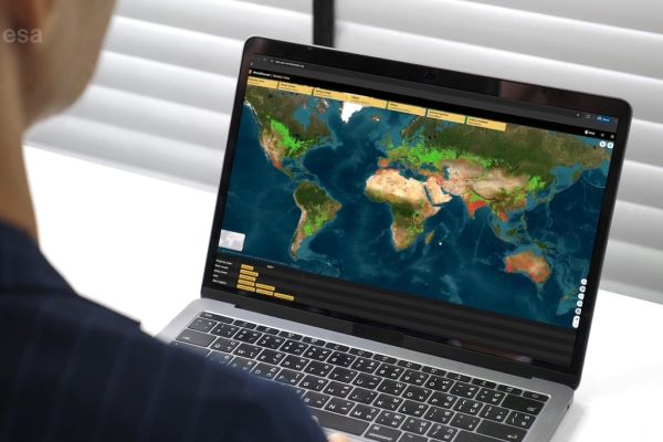
Every day, we are bringing remote sensing closer down to earth!
Seeing the huge potential of Earth Observation (EO) to deliver accurate spatial information, but at the same time noticing the lag with which this information is getting integrated and used in practice, Jeroen joined VITO Remote Sensing with the sole mission of developing and disseminating EO-based products and applications for land monitoring purposes. Currently, he is part of the agricultural applications team, focusing mainly on crop classification, irrigation mapping and drought monitoring. He is particularly passionate about in-situ data management and capacity building.