FRM4DRONES-AQUATIC
Advancing Drone-Based Measurements for Satellite Calibration and Validation of Aquatic Reflectance
Why Drones for Aquatic Calibration and Validation?
Unoccupied Aerial Vehicles (UAVs), or drones, have revolutionized environmental monitoring by offering flexible, high-resolution data collection. Unlike traditional fixed platforms like AERONET or HYPERNETS, drones can assess spatial variability around these stations, improving the representativeness of satellite pixel-scale measurements.
They can also perform transects from shorelines to open seas, providing critical data for validating atmospheric correction algorithms, such as adjacency corrections. This comprehensive approach enhances the accuracy and reliability of satellite Calibration and Validation (Cal/Val) processes.

Challenges and the Need for Fiducial Reference Measurements
High-quality Fiducial Reference Measurements (FRM) are essential for satellite product validation. Achieving FRM status for drone data over water involves several challenges such as:
- Addressing the high spatial and temporal variability of water bodies
- Accurate data processing from digital numbers to aquatic reflectance including corrections for glint effects
- Rigorous calibration
- Providing robust uncertainty budgets and International System of Units (SI) traceability
FRM4drones-AQUATIC
The FRM4DRONES-AQUATIC project aims to improve the reliability, traceability, and accuracy of drone-based aquatic measurements.
Through a collective community effort, the project seeks to:
- Bring together the community involved in drone-based aquatic Cal/Val
- Develop and discuss best practices
- Advance uncertainty quantification and standardization of protocols
By doing so, FRM4DRONES-AQUATIC paves the way for drones to become a trusted and complementary tool in the satellite validation ecosystem.
![]()
Online Workshops
Join our upcoming online workshops - more information below:
| Day | Time | Topic | Registration |
| Wednesday, 11 June, 2025 | 15:00-17:00h CET | Workshop 1: Data Acquisition and Processing Protocols | Registration closed |
| Thursday, 25 September, 2025 | 15:00-17:00h CET | Workshop 2: Uncertainty, FRM, and Traceability | Registration closed |
Program Workshop 2: Uncertainty, FRM, and Traceability (25 September, 2025)
The FRM4DRONES-AQUATIC workshop series brings together the community exploring drone-based approaches for aquatic reflectance measurements.
This second workshop will begin with an introduction to the principles of Fiducial Reference Measurement (FRM) and the benefits of aligning with these standards.
![]()
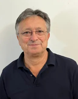
Introduction – Aga Bialek, NPL:
Principles of Fiducial Reference Measurement (FRM)
We will focus on:
- SI traceability and its role in ensuring measurement reliability
- Uncertainty evaluation and best practices
- The importance of instrument characterization
- Standardization of measurement protocols across platforms and institutions
The primary aim is to gather community perspectives on the path forward to achieving FRM status for drone-based aquatic reflectance measurements. Key objectives include:
- Identifying laboratories capable of supporting the necessary instrument calibrations and characterizations
- Exploring the potential for a comparison exercise to define common procedures and standards
- Discussing uncertainty evaluation, shared practices, and open-source resources available to support the community
Giuseppe Zibordi , EOScience:
Optical radiometry requirements for drone systems supporting ocean colour validation activities
The calibration and characterization of optical radiometers, as well as the application of consolidated data reduction methods and uncertainty analysis, are essential to support the validation of satellite data products with highly accurate in situ measurements. The talk will introduce requirements for above-water radiometry supporting ocean colour validation activities. It will furthermore present a drone-based system developed at the Joint Research Center of the European Commission targeting ocean colour applications while benefitting from community efforts on optical radiometry.
View presentation Giuseppe Zibordi
Robbie Ramsay , NERC Field Spectroscopy Facility (FSF) Calibration Laboratory:
Current Calibration Activities involving UAV Imagers and Underwater Optics
The NERC Field Spectroscopy Facility operates an optical calibration laboratory at Edinburgh, UK. In support of various URKI projects, the facility has worked in the development and implementation of calibration and charaterization (both in the spectral, radiometric and spatial domain) methods for spectroscopic instrumentation covering the visible to short wave infrared region. These projects have included the characterization and calibration of above and below water ocean colour radiometers, and hyperspectral images mounted to UAV platforms. An overview of the calibration methods employed, as well as challenges related to the marine environment and to the case of UAV mounted instrumentation, will be provided.
Andreas Baumgartner , Team Lead at the German Aerospace Genter (DLR):
DLR's Calibration Home Base for Imaging Spectrometers (CHB)
The Calibration Home Base (CHB) of the German Aerospace Center (DLR) is a calibration laboratory for imaging spectrometers. Originally developed for airborne sensors, CHB equipment has since been used to calibrate instruments deployed on a variety of platforms, including satellite and ground-based systems. Covering the spectral range from 380 nm to 2500 nm, the CHB provides instrumentation and expertise for calibrating key performance parameters of imaging spectrometers — including radiometric, spectral, geometric, and non-linear characteristics, as well as temperature dependence, stray light, and polarimetric response. Most calibration processes are automated and supported by a comprehensive software suite that streamlines measurement execution, data analysis, level-1 processing, and sensor simulation. For more than a decade, DLR's HySpex imaging spectrometers have undergone regular calibration updates and improvements, leading to enhanced CHB capabilities and improved data quality.
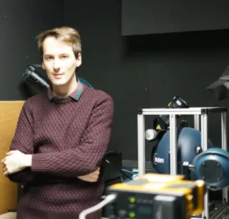
Stefan Plattner , Developer and Remote Sensing Expert at the German Aerospace Center (DLR):
LIMNOVIS: A new platform for optimized in-situ validation measurements at inland water bodies
UAVs offer the possibility to perform remote sensing reflectance measurements over water without the disturbing influence of a ship, including drift and rotation due to winds and currents, in having a constant measurement geometry during the entire measurement. Nevertheless, there are limitations such as a short flight duration, the effort involved in obtaining a permit, or the lack of the possibility of skylight-blocking or underwater measurements. To overcome these limitations, the LimnoVIS measurement platform was developed at DLR, which is a USV with the ability to maintain or change position and orientation independently of each other during the measurement. The on-board equipment includes a multiplexed spectrometer with gimbal-stabilized optics for Lu (both above water and skylight-blocked), Lsky and Ed, several reflectance panels, an echo sounder, and an underwater camera.
View presentation Stefan Plattner
Program Workshop 1: Data Acquisition and Processing Protocols (11 June, 2025)
This first online session focused on data acquisition and processing protocols, showcasing current practices and technical challenges while laying the groundwork for a collaborative roadmap toward standardised, high-quality methodologies.
![]()
Introduction – VITO:
Welcome & Introduction to the FRM4DRONES-AQUATIC Workshop: Toward Standardised UAV-Based Aquatic Reflectance
The workshop will open with an introduction to the FRM4DRONES- AQUATIC project, highlighting the motivation behind advancing drone-based aquatic reflectance measurements toward Fiducial Reference Measurement (FRM) standards. The main challenges in aquatic drone Cal/Val will be outlined. We will demonstrate, through selected case studies, the use of the MAPEO-Water processing chain as an example of UAV-based aquatic data processing to address some of these challenges. Finally, the objectives and structure of the workshop will be presented, with an emphasis on community engagement and the roadmap toward standardised protocols.
Anna Windle, Satellite Mission Post-Doctoral Fellow, SSAI (NASA GSFC):
Evaluation of Unoccupied Aircraft System (UAS) Remote Sensing Reflectance Retrievals for Water Quality Monitoring in Coastal Waters
Unoccupied aircraft systems (UAS) equipped with optical sensors offer on-demand, highly resolved data. Aquatic UAS applications are in their infancy, and the critical removal of light reflected directly off the skin of water has received little attention in the literature. This talk will describe several different approaches to remove direct surface reflectance from UAS imagery and evaluate each against in situ Rrs data. Furthermore, DroneWQ, a Python library for measuring water quality with a multispectral drone sensor, will be presented.

Carmen Cillero, Researcher at Estonian University of Life Sciences:
Experimental Set-Up and First Results of Drone-Based Radiometry. Future Needs and Potential for Satellite Cal/Val
This talk will describe the experimental set-up developed to integrate a spectroradiometer Ocean Optics STS on board an octocopter to perform point measurements of Rrs by flying a drone over bodies of water. The experimental set-up was tested in different OWTs and compared to a standard set of TriOs RAMSES Spectroradiometers Rrs measurements. We will explore together the possibilities that this approach may offer in the context of the project FRM4DRONES.

Alejandro Román, PhD in Marine Sciences & Technologies:
Novel Direct Georeferencing-Based Method for Accurate Water Surface Mosaicking with Drone Multispectral Imagery
Unoccupied Aircraft Systems (UAS or drones) enable comprehensive observation of marine systems with high spatial and temporal resolutions. However, water surfaces are optically dynamic, and the absence of fixed features precludes the applicability of common terrestrial photogrammetric mosaicking techniques, thereby limiting the ability to monitor water quality using multispectral technology. This study presents an efficient, precise, and benchmark mosaicking method that directly addresses this limitation. A Python-based georeferencing approach leverages image orientation and associated UAS metadata collected during pre-programmed surveys. The integration of this open-source and intuitive technique, alongside emerging surface reflectance retrieval methods, helps advance UAS monitoring in coastal environments.

Interactive Discussions – VITO / all
Funding and Partners
This project is supported by:
![]()
![]()
Project partners:
![]()
![]()