Kasper Bonte
R&D Professional
Kasper Bonte graduated as a Master in Physical geography at the KU Leuven and gained his experience in remote sensing during his thesis. In this thesis, he combined Sentinel-1 & Sentinel-2 data to create a rice classification map for the rice granary of Madagascar. The huge amount of data and the great potential satellite data could offer for facing human related problems, attracted him to join the VITO agricultural application team in 2019.
Remote sensing data offer a great potential of addressing many sustainable development goals in the field of agriculture. Let’s make use of it!
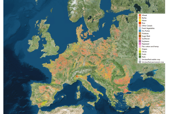
Within VITO, Kasper is using remote sensing technologies to map agricultural practices and crop phenology from regional to continental level within projects like HRL-VLCC. Furthermore, he also has quite some experience in automatic processing satellite imagery and turning it into EO-based services.