Copernicus Land Monitoring Service Releases New HRL Products for Europe (2017-2021)
VITO Developed the Newly Added High-Resolution Layer Cropland Component
On May 13, 2025, the European Environment Agency (EEA) released the latest High-Resolution Layers (HRL) under the Pan-European component of the Copernicus Land Monitoring Service (CLMS). This important release ensures the continuation and further densification of the existing HRL Forest and HRL Grassland products. Most notably, it marks the extension of the HRL portfolio with the addition of a brand-new layer: HRL Cropland, a long-awaited step to close the gap in cropland information within the CLMS offering.
HRL Portfolio Structure
The HRL portfolio includes both:
- Status layers at a spatial resolution of 10 meters, describing land cover at a specific point in time
- Change layers at 20 meters, capturing land-cover dynamics and trends over time

About the New HRL Cropland Products
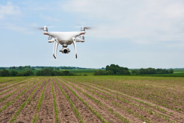
Developed by VITO, the HRL Cropland layer delivers high-resolution insights into crop types and cropping patterns across Europe. All cropland products are provided at 10-meter spatial resolution and are designed to support agricultural monitoring at continental scale.
The cropping pattern products are divided into five thematic indicators reflecting real-world farming practices:
- Main crops: information on emergence, harvest, and the duration of the main growing season
- Bare soil: duration of bare soil periods before and after the main crop cycle
- Secondary crops: presence and characteristics of additional crop cycles
- Fallow land: detection and duration of agricultural parcels that remained temporarily unmanaged
- Annual crop characteristics: number of crop cycles (up to two per year) and crop rotation trends over a three-year window
These new products enable comprehensive assessments of cropland management at the European level and support monitoring of seasonal and interannual agricultural changes.
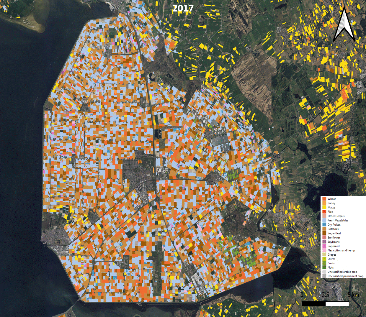
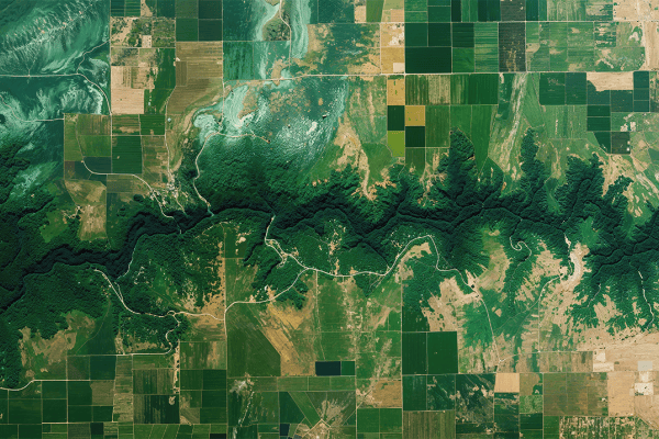
Crop type evolution in an agricultural region of the northwest Netherlands
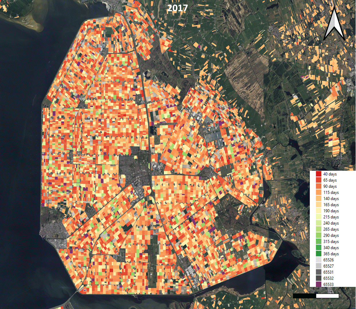
Main crop duration evolution in an agricultural region of the northwest Netherlands

Interested in analysing the European agricultural landscape? You can access the new CLMS High Resolution Layer Croplands datasets here:
Looking Ahead
Additional releases of the HRL layers are planned for the period 2022-2024 and will again include full coverage of the United Kingdom.
About the HRL Consortium
The HRL products have been developed by a consortium of European partners under contract with the European Environment Agency (EEA). The consortium is led by GAF (Germany), who is responsible for the development of the HRL Forest products. GeoVille (Austria) oversees the development of the HRL Grassland products and manages the data dissemination. VITO (Belgium) developed the newly released HRL Cropland products. Together, these partners contribute to the continued evolution and enrichment of the Copernicus High-Resolution Layers under the CLMS.