Geo intelligence for real-world agriculture answers
At VITO Remote Sensing, we go beyond earth observation data and satellite imagery to give you practical agriculture answers.
Increase yields locally, secure food globally
Sustainable agriculture comes with several challenges. You need to increase yield, while simultaneously reducing environmental impact. You need to cope with extreme weather events and the effects of climate change, while avoiding spikes in food prices and excessive production costs. New agricultural practices and innovations are being implemented, but their short- and long-term effects are still not entirely clear. How do you know if the intended effectiveness is achieved and contributes to a more resilient agriculture ánd environment? With geo intelligence, you’re able to monitor exactly what your smart farming is delivering … And see how to make it deliver even more.
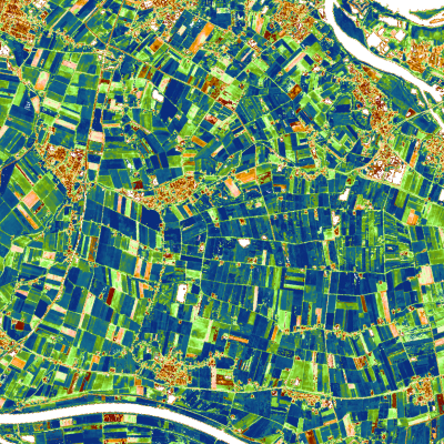
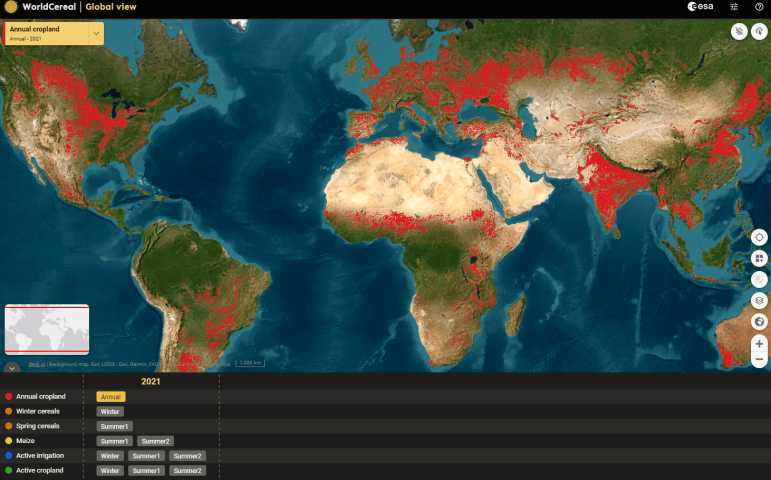
WorldCereal, seasonally updated cropland and crop type maps
In 2023 ESA WorldCereal released the first dynamic system to provide cropland and crop type maps at 10 meter spatial resolution. As from December 2023, the WorldCereal consortium entered a new 3-year phase in which the team will boost user uptake of the system by the broad agricultural monitoring community.
The WorldCereal consortium consists of a team of experts. VITO is prime contractor of WorldCereal and will build upon its experience of leading several scientific and operational projects including e.g. Copernicus Global Land and ESA WorldCover. Discover more about the team, products and upcoming capacity building activities on the WorldCereal website
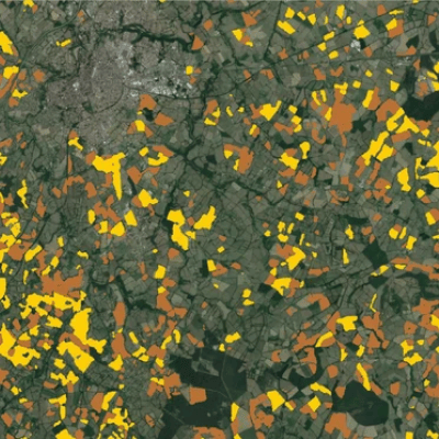
Data and insights for genuinely smart farming and high-precision agriculture
VITO Remote Sensing provides global, independent, timely and qualitative information and monitoring services for precision agriculture and smart farming. They range from highly detailed millimetre-level characterisation of plant organs to mapping of global agricultural patterns. An incredible amount of data … But don’t worry, we process all this data to ensure you get the information and insights you need, relieving you from the difficult and massive data processing. You’ll identify diseases before they’re even visible to the human eye. You’ll monitor growth and use high-precision tracking of trial plots, multiplication, or production fields. All information you need to make properly informed, data-based decisions will be brought to you in a user-friendly environment. With the integrated archives of Earth Observation, meteorological and in situ data at your fingertips – and in different resolutions – you will have a genuinely global ánd local view.