MAPEO Water
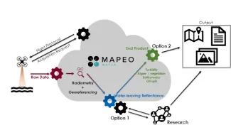
MAPEO Water provides a processing workflow in the cloud for aerial drone images visualizing water bodies like a river, lake or sea.
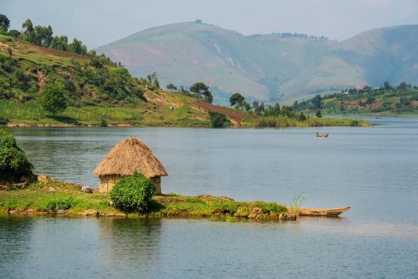
Water body characterization with drones
MAPEO Water allows us to process aerial drone images of water bodies like a river, lake or sea. With the MAPEO Water processing workflow we can obtain georeferenced images with corrected quantitative values representative for the water column. This allows us to derive information such as, but not limited to, turbidity or chlorophyll concentrations.
The water case has some specific challenges that need to be tackled. Some of these issues are listed below:
- Water bodies often look dark on images resulting in a much lower signal-to-noise ratio compared to land applications.
- The interaction of the incoming light with the atmosphere just above the water surface might have a major influence (sky glint). Luckily, this can be modelled through a modified version of VITO’s atmospheric correction algorithm iCOR (iCOR4Drones).
- The water surface acts as a mirror (sun glint). Therefore, a well-adapted flight protocol and hardware setup is indispensable.
- The water column is often a dynamic environment subjected to e.g. current or tide resulting in a rapidly changing scene under investigation.
Georeferenced products and hardware setups
You can obtain georeferenced products such as:
- Water-leaving reflectance (intermediate product)
- Turbidity
- Suspended sediments
- Chlorophyll
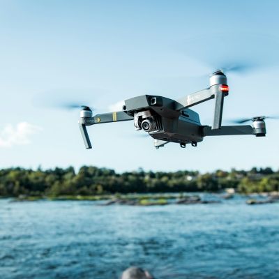
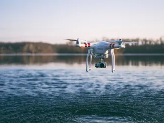
mapEO water also supports a series of hardware setups:
- RGB
- DJI Phantom 4 Pro (version 1)
- DJI Phantom 4 Pro (version 1)
- Multispectral
- MicaSense RedEdge-M + auxiliary sensors (DLS-1)
- MicaSense RedEdge-M + auxiliary sensors (DLS-2)
- MicaSense Dual Camera + auxiliary sensors (DLS-2)
- DJI P4 Multispectral
Data upload to the MAPEO backend for further processing can be easily done through the Fieldsoftware tool. This software also performs a first quality control while in the field. Guidelines for data collection and upload are available (p. 29 onwards).
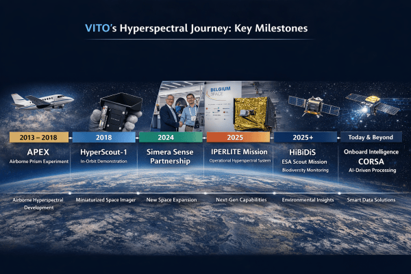
Over the past years, VITO Remote Sensing built up an expertise in water body characterization from drones through different research projects supported by Belspo (DroneSED) and the European Commission H2020 program (MONOCLE).
Are you interested to learn more about the value of the output of MapEO water? Contact us to see if we can setup a test campaign to demonstrate how mapEO can support your projects.
Want to know more?
Do you want to know more about MAPEO Water? Let us know what you need and we'll get in touch.
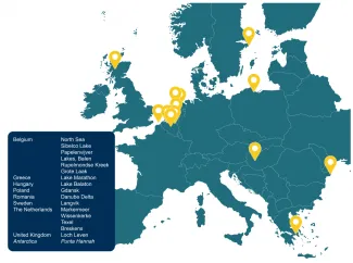
Demonstration locations
-
Wissenkerke, the Netherlands
The European water Framework Directive requires member states to monitor water quality aspect related to algae blooms. In the Netherlands, monitoring is performed by Rijkswaterstaat (RWS) with systematic in situ point measurements taken by vessels.
To better assess chlorophyll-a and turbidity in dynamic waters sucs as the Scheldt, drone observations can be used.
Read our blog: Monitoring tidal influence on algae with drones
-
Texel, the Netherlands
MAPEO-water was tested in Texel, where dune construction works were taking place. To estimate the impact of the construction activities on the water quality, monitoring efforts were established. Adding drone imagery to this database provides additional information on the spatial gradient of water quality at the surface. Raw drone data were converted into turbidity maps and a validation was performed with in-situ data collected simultaneously with the drone flights.
Read the paper: terra-et-aqua-157-complete.pdf( (iadc-dredging.com)
-
Lake Marathon, Greece
Drones can be used to monitor drinking water intakes, as demonstrated for the Athens Water Supply and Sewerage Company (EYDAP). In Lake Marathon, several locations were monitored with drones and raw drone data was converted into turbidity and chlorophyll-a products with MAPEO-water.
-
Grote Laak, Belgium
The Flemish Environment Agency used drones to support exavation works in the river Grote Laak in Belgium. Because of the small width of the river, drones are ideal to follow up the turbidity plumes generated in the river.
Webinar: MAPEO Water drone-based water monitoring
Related papers:
- Airborne Drones for Water Quality Mapping In Inland, Transitional and Coastal Watrs - MAPEO-Water data Processing and Validation
Liesbeth De Keukelaere, Robrecht Moelans, Els Knaeps, Sindy Sterckx, Ils Reusen, Dominique De Munck, Stefan G.H. Simis, Adriana Maria Constantinescu, Albert Scrieu, Georgios Katsouras, Wim Mertens, Peter D. Hunter, Evangelos Spyrakos, Andrew Tyler
Read the full paper.
- Mapping water quality with drones - test case in Texel
De Keukelaere, L., Moelans, R. Strackx, S., Knaeps, E., Lemey, E. 2019. Mapping water quality with drones - Test case in Texel. Terra et Aqua, 157, 6 - 16.
Read the full paper in 'Terra et Aqua', IADC's quarterly publication.
Liesbeth De Keukelaere received the IADC Young Author Award for co-authoring of this research paper at the CEDA Dredging Days 2019. Click here for more information about this award.
Related documents:
- Operational protocols for acquisition and deployment
- Drone data acquisition over water bodies with DJI Phantom 4 Pro
- Micasense RedEdge-M integrated under DJI Phantom 4 Pro
- Drone data upload tool: Field software
Related blog articles:
- Drones and dredging! Is there a match? - Liesbeth De Keukelaere
- How to integrate a multispectral camera under a low-cost drone - Robrecht Moelans
- Drones to monitor water quality - Dries Raymaekers
- Monitoring tidal influence on algae with drones - Willem Boone
- Water quality monitoring! From knowledge to operational services - Els Knaeps