Mapping Plastic Pollution From Seabed to Space
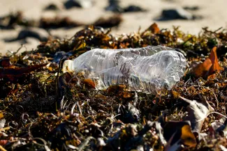
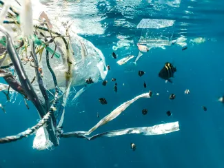
Plastic litter is everywhere in the environment, although these unwanted items can have an impact on ecosystems. These materials are very diverse in shape, size, colour, type, and density. Plastic litter accumulates in various compartments of rivers and seas, ranging from the intertidal zone, the water surface, the water column to the seabed. There is not a single method to detect the diversity of plastic litter in these multiple compartments, and so there is a need to combine multiple solutions. That is where the combination of multiple remote sensing technologies – like drone-associated cameras, underwater acoustics, and satellite images – comes in as a cost-efficient, innovative joint detection solution, enabling to target problematic accumulation areas and clean them in a more efficient way.
Detection methods, that's where the SSPIRIT project comes into play. SSPIRIT stands for 'From Seabed to SPace: Identifying and quantifying plastic litteR with Innovative remote sensing Technologies'. The overall goal of this project is to develop and test a comprehensive, cost-efficient portfolio of systems and technologies to map plastic pollution in all compartments of the water column, from the surface to the seabed.
A Flemish Collaboration With International Ambitions
SSPIRIT is a Flemish, three-year cluster Strategic Basic Research (cSBO) project that runs from June 2025 until May 2028. It is a collaboration between VITO Remote Sensing, VLIZ, KU Leuven, University of Antwerp, Ghent University, Flanders Space, and Blue Cluster. The funding comes from VLAIO, the Flemish Agency for Innovation & Entrepreneurship.
The scope of the project is global, and we will test the innovative SSPIRIT framework in the Belgian part of the North Sea and the Scheldt estuary to effectively assess and develop a combined portfolio of monitoring methodologies. SSPIRIT focuses on open science and FAIR principles to broaden the applicability of the findings to global estuaries, coastal waters, and satellite observations. As such, Flanders strengthens its position as an innovative region where novel techniques are being developed, feeding into marine environmental policies and initiating sustainable technologies.
State-of-the Art Remote Sensing Technology
SSPIRIT uses state-of-the-art remote sensing technologies and advanced (AI) data processing and modelling pipelines to identify and quantify plastic litter (micro-, meso- and macroplastics) across multiple water compartments. By bridging disciplines, this project seeks to provide a clearer understanding of the pathways of plastic pollution detection.
SSPIRIT's objectives:
- Improve the science case for a dedicated satellite mission
- Evaluate the feasibility of remote optical detection of plastic pellets (via smartphones and drones)
- Boost the recognition potential for macro-litter using cameras (GoPro) and acoustic (Blueview and multibeam) methods
- Assess potential microplastic hotspots using remote sensing techniques
- Strengthen the performance of a depth-averaged (Eulerian) particle transport model to predict turbidity (i.e., the cloudiness or haziness of the water) and associated microplastic concentrations
- Optimise the performance of a depth-averaged (Eulerian) particle transport model to predict pellet loss dispersal
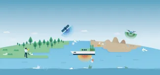
Illustration of the remote sensing technologies used in the SSPIRIT project to detect plastic pollution across the different water compartments
SSPIRIT’s Six Technology Cases
In the SSPIRIT project, researchers will develop six technology cases to test and develop solutions for detecting plastic litter in riverine and coastal environments.
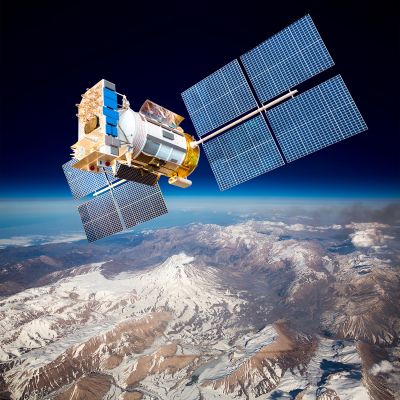
- Technology Case 1: Optical VNIR-SWIR (Visible Near Infrared and Short-Wave Infrared Spectroscopy) satellite mission (satellite monitoring of plastics)
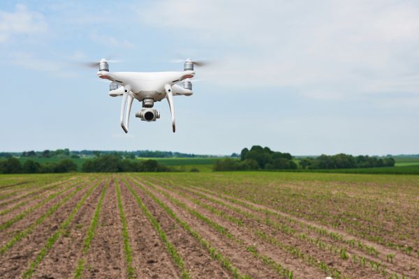
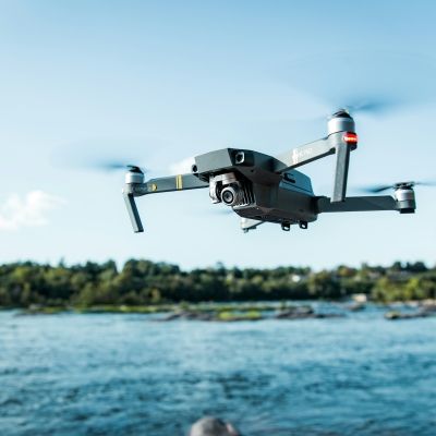
- Technology Case 2: Ecogeomorphology from drones as proxy for stranded pellets (indirect detection of stranded pellets)
- Technology Case 3: Optical VNIR-SWIR camera and smartphone technology (direct detection of stranded pellets)
- Technology Case 4: Camera and acoustic detection of litter in the water column
- Technology Case 5: Multibeam detection of litter on the seabed
- Technology Case 6: Suspended particulate matter (SPM) or turbidity as a proxy for microplastic concentrations
SSPIRIT will also establish an Innovation Accelerator, a structure that helps Advisory Board members and industry use and implement the developed tools and knowledge. Throughout the project, we will continue to refine existing and explore novel valorisation trajectories. Our team will initiate at least five valorisation trajectories and follow-up initiatives to ensure continuity after the project will have ended.
Project partners:
![]()
In collaboration with clusters:
![]()
Funded by:
![]()