EMPHASIS-Belgium roadshow – first stop: UGent
Are you a plant researcher, breeder, agronomist, ecologist, remote sensing specialist, or data scientist interested in plant phenotyping?
Join us at Ghent University on Monday, 7 December 2026, for the first stop of the new EMPHASIS-Belgium Roadshow. Discover UGent’s diverse plant phenotyping activities and take part in VITO’s hands-on MAPEO workshop: From Drone Images to Phenotypic Insights. Connect with the plant science community, explore innovative technologies, and discover opportunities for collaboration in plant phenotyping.
About EMPHASIS-Belgium
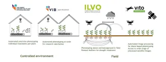
Within EMPHASIS-Belgium, VITO collaborates with VIB and ILVO to provide the (inter)national research community with access to advanced plant phenotyping facilities and expertise. Together, we cover a broad range of observation scales, from controlled indoor environments (VIB), to highly instrumented field trials (ILVO), and large-scale field monitoring using drones and Earth observation technologies (VITO).
Ready for Our Roadshow?
At the same time, there is a vibrant and growing ecosystem of plant science researchers across Flanders. Plant physiologists, breeders, agronomists, ecologists, remote sensing specialists, crop scientists, data scientists, and phenotyping experts are all developing innovative methods and applications that contribute to the future of plant research. With so much expertise available, we believe it is time to hit the road, connect with the community, exchange ideas, and explore how emerging technologies, infrastructures, and research needs can fit into the broader phenotyping landscape.
Introducing Phenotyping Activities by UGent
We are therefore delighted that Ghent University will host the first stop of the EMPHASIS-Belgium Roadshow. The session will showcase some of UGent's leading plant science and phenotyping activities through the following presentations:

Applied Mycology and Phenomics
by Noémie De Zutter
About LAMP
Predictive Breeding
by Steven Maenhout

UAV Research Centre
by Wouter Maes
About URC
MAPEO Workshop
From Drone Images to Phenotypic Insights
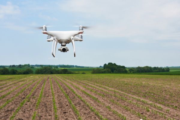
In addition to the overview of phenotyping research at UGent, VITO will organise a hands-on workshop on MAPEO, its cloud-based drone image processing platform for agricultural and phenotyping applications. Over the past two years, MAPEO has been significantly expanded with new capabilities designed to support operational research workflows:
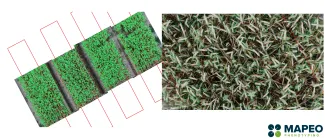
- Enhanced plot design functionality and visualisation of plot statistics
Easily create, import and overlay digital plot designs on drone-derived products and automatically extract plot-level statistics. - High-resolution satellite imagery integration
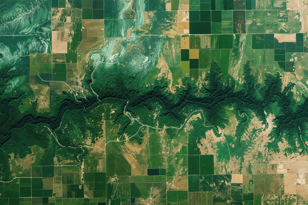
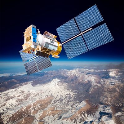
MAPEO now supports the acquisition and processing of Planet SkySat imagery at up to 0.5 m spatial resolution. Researchers can task imagery for specific locations and time periods, after which data are quality-checked, processed, and transformed into overview and NDVI products. This enables direct integration and comparison of satellite and drone observations within a single platform. - Mission quality reporting
Quality indicators such as geometric accuracy, field coverage, and multispectral calibration are automatically calculated, visualised, and exported for every drone mission. - Drone sampling mission support
User-defined Digital Surface Models can now be used to plan and execute advanced drone sampling missions, including low-overlap and plot-driven flight planning for DJI M3E, M3M, and M3T sensors - Integration with droneSTAC (in progress)
Beyond data analysis, VITO is developing droneSTAC, an open repository that enables researchers to archive, discover, and share drone datasets in a FAIR and cloud-optimised environment hosted on Terrascope.
Who Should Attend?
This workshop is intended for:
Domain experts exploring drone-based phenotyping
- Breeders, agronomists, crop scientists and plant physiologists
- Ecologists and ecosystem researchers working on vegetation monitoring
- Researchers interested in exploring how drone and Earth observation technologies can support their research questions
Technology experts supporting research workflows
- Remote sensing and geospatial data specialists
- Data scientists integrating drone, satellite and field observations
- Experts interested in operationalising image analysis and phenotyping workflows within research projects
- Researchers and developers looking to connect their technologies, methods and tools with the broader phenotyping community
Whether you are new to phenotyping or already operating advanced sensing infrastructures, this session provides an opportunity to discover available facilities, exchange experiences, and explore future collaborations within the Belgian and European plant phenotyping ecosystem.