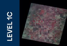
Image Processing Tool
Transform raw satellite data into actionable imagery with VITO’s Image Processing Tool (IPT). Professional-grade image processing for the Simera Sense xScape optical camera range. From raw Level 0 data to orthorectified, radiometrically calibrated products.

End-to-End Image Processing
Earth observation satellites collect vast amounts of data for environmental monitoring, agriculture, urban planning, and disaster management. IPT transforms this raw data into calibrated, analysis-ready products.
![]()
Satellite-Ready
Designed for the Simera Sense xScape product range, handling multispectral and hyperspectral payloads.
![]()
Multi-Level Processing
From raw L0 data through radiometrically and geometrically corrected L1B to fully orthorectified L1C products.
![]()
Precise Georeferencing
Direct georeferencing using satellite telemetry with GPS positioning and star tracker attitudes.
![]()
Calibrated Radiometry
Convert raw digital numbers to TOA (Top of Atmosphere) radiance or reflectance with per-pixel DSNU and PRNU corrections.
From Raw Data to Analysis-Ready Products
Professional-grade image processing. From raw Level 0 data to orthorectified, radiometrically calibrated products.

Raw Data
- Data decompression
- Packet assembly into full frames
- Time tagging and GPS synchronization
- Storage in GeoTIFF and JSON format
Output: Unprocessed instrument data, telemetry (position, velocity, attitudes), and auxiliary metadata.

Radiometric and Geometric Correction
- Interbands geometric correction (band co-registration)
- Direct georeferencing using satellite telemetry
- RPC coefficient generation
- Per-pixel DSNU correction (dark signal)
- Per-pixel PRNU gain correction (flat-field)
- Optional vertical and horizontal destriping
- TOA radiance to TOA reflectance conversion (optional)
Output: TOA radiance/reflectance in sensor geometry with each pixel georeferenced. Full resolution.
Orthorectification and Projection
- Orthorectification using DEM for terrain relief
- Projection to UTM/WGS84 coordinate system
- Resampling to fixed grid at native GSD
- RGB quicklook and thumbnail generation
Output: Orthorectified TOA radiance/reflectance in UTM projection, ready for geospatial analysis.
Key Radiometric Steps
DSNU Correction
Dark signal non-uniformity removal using lab offset and dark current data
PRNU Correction
Photo response non-uniformity correction from lab flat-field characterization
Destriping
High-frequency equalization in vertical and horizontal directions
TOA Conversion
Normalisation by solar irradiance, Sun-Earth distance, and solar zenith angle
On request, VITO can provide access to the atmospheric correction software tool iCOR, which produces Top of Canopy (TOC) surface reflectance products.
Two Powerful Offerings
Choose the processing level that matches your application requirements.
![]()
Express Image Processing
Rapid processing for a first glance at image characteristics. Uses ancillary satellite/camera metadata for geolocation and pre-flight characterisation for basic radiometric correction.
- Fast turnaround for quick image assessment
- Pre-flight calibration coefficients
- Satellite telemetry-based geolocation
- L1B and L1C product generation
- Interbands geometric correction
- Direct georeferencing with RPC generation
![]()
Advanced Image Processing [Recommended]
End-to-end solution with vicarious calibration powered by VITO. In-flight calibration refines radiometric and geometric coefficients for high-accuracy products suitable for downstream applications.
- Everything in Express, plus:
- Vicarious in-flight radiometric calibration
- Dark current update from night-time orbits
- Absolute calibration using Libya-4, Niger-2, RadCalnet
- Cross-validation with Sentinel-2A and 2B
- Geometric calibration with bundle adjustment and GCPs
Product Structure and Deliverables
All Level 1 products are delivered in standard Cloud Optimized GeoTIFF format for seamless use across GIS and scientific platforms.
Level 1B Product
Sensor geometry • Full resolution • Scene-based framing
- Image Files (Cloud Optimized GeoTIFF)
Per-band TOA radiance or reflectance at full resolution in sensor geometry. DEFLATE compressed, 512 by 512 block size. - Meta-Data File (JSON)
Key-value pairs with acquisition time, geolocation, processing info, quality flags, and sensor parameters. - Contour File (KML)
Footprint contour of the product viewable in Google Earth and GIS platforms. - RPC File (Text)
Rational Polynomial Coefficients for georeferencing and orthorectification by third-party tools.
Level 1C Product
UTM/WGS84 projection • Orthorectified • Scene-based framing
- Image Files (COG)
Orthorectified TOA radiance or reflectance in supported geographic or UTM/WGS84 projections. - Meta-Data File (JSON)
Complete metadata with CRS info, pixel size, EPSG code, and processing parameters. - Contour File (KML)
Product footprint in geographic coordinates, with embedded RGB quicklook. - Quicklook (COG 8-bit RGBA)
False-colour composite with JPEG compression for rapid visual inspection. Includes alpha transparency. - Thumbnail (JPEG)
Sub-sampled preview image for fast visualization without CRS assignment.
Comprehensive Product Metadata
Every product includes detailed metadata in JSON format covering acquisition parameters, geolocation, processing history, and per-pixel quality flags.
General
| LEVEL0_PRODUCT_REFERENCE | Unique reference of the input Level 0 product |
| LEVEL1_PRODUCT_REFERENCE | Unique reference of the output Level 1B or Level 1C product |
| PROCESSING_LEVEL | LEVEL1B or LEVEL1C |
| START_ACQUISITION_TIME | Start date and time in YYYYMMDDThhmmssZ format |
| STOP_ACQUISITION_TIME | Stop date and time in YYYYMMDDThhmmssZ format |
| IPT_VERSION | IPT software version identifier |
| PROCESSING_TIME | Date and time of product generation |
Geolocation
| FOOTPRINT_WKT / GEOJSON | Product contour in WKT or GeoJSON using lon, lat coordinates |
| BBOX_MIN/MAX X/Y/LON/LAT | Bounding box coordinates in projection and geographic units |
| CENTER_X / CENTER_Y / LON / LAT | Center coordinates of the product |
| SAA / SZA / VAA / VZA | Solar and viewing azimuth and zenith angles summarized as min and max values |
CRS
| CRS_PROJ4 / CRS_WKT / CRS_EPSG | Coordinate reference system encoded as PROJ4, WKT, and EPSG |
| GSD | Ground sampling distance in meters |
Quality Flags
Each pixel includes a radiometric quality status indicating its reliability, from nominal readings to flagged anomalies such as missing pixels, saturation, negative conversion values, or interpolated values. Metadata also summarizes the percentage of each status per band.
Built for Real-World Applications
![]()
Environmental Monitoring
Track vegetation health, land cover changes, and ecosystem dynamics with calibrated multispectral imagery.
![]()
Urban Planning
High-resolution orthorectified imagery for urban mapping, infrastructure assessment, and land use classification.
![]()
Disaster Management
Rapid assessment of natural disasters with quick-turnaround Express processing for emergency response.
![]()
Scientific Research
Calibrated TOA radiance or reflectance data for atmospheric studies, radiometric validation, and cross-sensor analysis.
![]()
Data Archival and Reprocessing
Level 0 raw data preservation enables future reprocessing as algorithms and calibration models improve.
![]()
Higher-Level Products
Level 1 serves as input for Level 2 atmospheric correction and downstream exploitation workflows.
Frequently Asked Questions
The IPT (Image Processing Tool) is a processing solution for the Simera Sense xScape optical camera range. It converts raw satellite acquisitions into structured product levels with increasing calibration, geolocation, and usability.
The specification describes three main product levels:
- Level 0: raw satellite data with minimal processing.
- Level 1B: radiometrically corrected or calibrated and geo-referenced data that remains in sensor geometry.
- Level 1C: orthorectified and projected data suitable for direct geospatial analysis.
Express processing relies on pre-flight laboratory radiometric measurements and ancillary satellite or camera metadata to geolocate and correct imagery. It does not include in-flight calibration.
Advanced processing adds in-flight vicarious radiometric calibration and advanced geometric calibration to improve absolute radiometric and geolocation performance.
A Level 0 product is raw, unprocessed data directly acquired from the satellite. It is primarily organized and packaged rather than corrected. Typical content includes original sensor readings, time and location stamps, telemetry, and auxiliary metadata.
Level 0 focuses on data integrity and preparation for later stages. Key steps include data decompression, packet assembly into frames or swaths, time tagging and synchronization, and storage in a standard archival format. No radiometric or geometric correction is applied at this stage.
Level 1B provides Top-of-Atmosphere radiance or reflectance data after radiometric and geometric processing. The data remains in sensor geometry, but each pixel is linked to geographic information.
Level 1C adds orthorectification and projection, producing georeferenced, radiometrically corrected or calibrated imagery aligned to a fixed map grid. It is intended for direct geospatial analysis and operational use.
- Interband geometric correction
- Direct georeferencing using telemetry, position, velocity, and attitude data
- RPC generation for geometric modelling
- Radiometric processing from DN to TOA radiance or TOA reflectance
- Optional vertical and horizontal de-striping
- Band-specific grayscale quicklook generation
It corrects spectral band misregistration, where the same ground point is not perfectly aligned across bands. This improves multispectral and hyperspectral analysis quality for tasks like classification, vegetation monitoring, and change detection.
Direct georeferencing uses satellite position, velocity, attitude, and sensor line-of-sight information to estimate the geographic location of pixels on Earth, typically expressed as longitude, latitude, and height.
Rational Polynomial Coefficients (RPCs) are mathematical coefficients that approximate the relationship between image coordinates and ground coordinates. They simplify georeferencing and orthorectification without requiring full detailed sensor models in downstream software.
Radiometric processing corrects raw digital numbers and converts them into physical values. The workflow includes dark signal non-uniformity correction, gain and PRNU correction, optional conversion from TOA radiance to TOA reflectance, and optional high-frequency equalization and destriping.
The advanced option adds in-flight vicarious calibration. It refines radiometric and geometric calibration coefficients after launch, including dark current updates, radiometric checks over desert sites, RadCalNet-based assessment, Sentinel-2 comparison, and geometric calibration using bundle adjustment and ground control points.
Level 1 products serve as input for Level 2 processing. On request, VITO can provide atmospheric correction using our iCOR tool), which produces Top of Canopy (TOC) surface reflectance products.
Level 0 is delivered in raw binary format specific to onboard instruments. Level 1 products use standard Cloud Optimized GeoTIFF for image datasets, plus associated JSON metadata, KML footprint files, and in some cases RPC, TIFF quicklook, and JPEG preview files.
A Level 1B product typically includes a parent product directory, a contour KML file, a JSON metadata file, band subdirectories for spectral-band files, and band-specific datasets such as LTOA, RTOA, quality grids, angle grids, latitude and longitude grids, height grids, and RPC files.
A Level 1C product includes a contour KML file, a JSON metadata file, an RGB quicklook TIFF, an RGB preview JPEG thumbnail, and band subdirectories with LTOA, RTOA, quality, angles, and height datasets.
Level 1C image files can be delivered in either Geographic Lat/Lon (EPSG:4326) or UTM/WGS84, using the relevant EPSG:326xx or EPSG:327xx code depending on hemisphere and zone.
The RGB quicklook is a false-colour COG file built from four 8-bit bands: red, green, blue, and alpha transparency. It is optimized for visual inspection and uses JPEG compression internally.
The RGB preview thumbnail is a downsampled JPEG intended for fast browsing and quick visual inspection. It has no assigned coordinate reference system.
Metadata covers acquisition timing, satellite and sensor details, processing level, geographic coverage, quality indicators, and processing history. It is delivered in a JSON-style key-value format organized by sections.
The General section includes references for the input Level 0 product and output Level 1 product, the processing level, start and stop acquisition times, the IPT software version, and the product generation time.
The Geolocation section includes the footprint in both WKT and GeoJSON form, bounding box coordinates, center coordinates, and scene-level angle summaries such as minimum and maximum solar azimuth, solar zenith, viewing azimuth, and viewing zenith.
The CRS section provides the coordinate reference system as a PROJ4 string, a WKT string, and an EPSG code. It also records the ground sampling distance as a formatted value in meters.
The Instrument_Configuration section stores band-level TDI settings, binning factor, and the imager acquisition mode, such as snapshot mode, line scan mode, or high accuracy hyperspectral mode.
The Calibration section includes references to the geometric and radiometric ICP files, boresight and payload-to-body-fixed angles, leap seconds, and polar motion information such as Bulletin-B reference, Delta UT1, and polar motion X and Y coordinates.
The Processing_Steps section indicates whether interband geometric correction and absolute geometric correction were applied, what radiometric output type was generated, and whether high-frequency equalization was applied in across-track and along-track directions.
The Radiometric_Quality section summarizes band-by-band percentages of correct pixels, interpolated pixels, missing pixels, negative pixels, and saturated pixels, making it easier to assess scene usability without reading every quality grid manually.
Both product types use a directory naming pattern that combines a free-form prefix with the processing level and the scene start acquisition timestamp. The patterns are <PREFIX>_LEVEL1B_<START_ACQUISITION_TIME> and <PREFIX>_LEVEL1C_<START_ACQUISITION_TIME>.
A Level 1B band folder can include TOA radiance or reflectance files, radiometric quality grids, grayscale quicklooks, viewing and solar angle files, longitude and latitude grids at different heights, altitude grids, and RPC files.
A Level 1C band folder can include TOA radiance or reflectance files, radiometric quality grids, viewing and solar angle files, and altitude grids. Unlike Level 1B, Level 1C focuses on projected image products rather than sensor-geometry longitude and latitude layers and RPC packaging.
The specification states that Level 1 image files are Cloud Optimized GeoTIFFs with full-resolution pixels plus lower-resolution overviews for efficient access and display. They use DEFLATE compression and a 512 by 512 block size for the core image datasets.
Each COG image file includes at least three core metadata tags: NoData, Description, and Unit Type. These help users interpret dataset values consistently across tools.
The RPC file stores bias and random error values, line and sample offsets and scales, latitude, longitude, and height offsets and scales, and the numerator and denominator coefficient sets for line and sample transformations.
No. The specification says Level 1B does not include RGB quicklooks. Instead, it provides grayscale quicklooks per spectral band in sensor geometry.
The Level 1C contour KML contains the product footprint and an embedded RGB quicklook, allowing convenient inspection in tools such as Google Earth.
Each Level 1B and Level 1C spectral band includes a radiometric quality grid that stores per-pixel status. Product metadata also reports percentages of correct, missing, interpolated, negative, and saturated pixels per band.
0 = good pixel
1 = missing pixel
2 = input DN saturated
3 = became saturated during DN-to-TOA conversion
4 = became negative during DN-to-TOA conversion
5 = interpolated from neighbouring pixels
Choose Level 1C when you need spatially corrected imagery ready for GIS workflows, mapping, monitoring, or direct geospatial analysis. Choose Level 1B when you need full-resolution sensor geometry with detailed geometric modelling and product-side georeferencing information.
Express processing uses direct georeferencing from satellite GPS and star tracker data. Advanced processing adds geometric calibration with bundle adjustment and accurate Ground Control Points (GCPs) to derive refined interior and exterior orientation parameters, achieving superior absolute geolocation accuracy.
IPT is designed for the Simera Sense xScape optical camera product range (xScape 50 (TS,HS,MS), xScape 100 (TS,HS,MS), xScape 200 (TS,MS)) supporting both multispectral and hyperspectral payloads with instrument-dependent spectral band configurations.
IPT is a collaboration between Simera Sense and VITO (Flemish Institute for Technological Research). VITO provides the processing software and vicarious calibration services, while Simera Sense offers the camera hardware and integration.